Rayalaseema has been under the clutches of having been recorded poor rainfall since July this year. June was terrific though but July to September remained mostly in lull phase. See the below image, you will understand clearly.

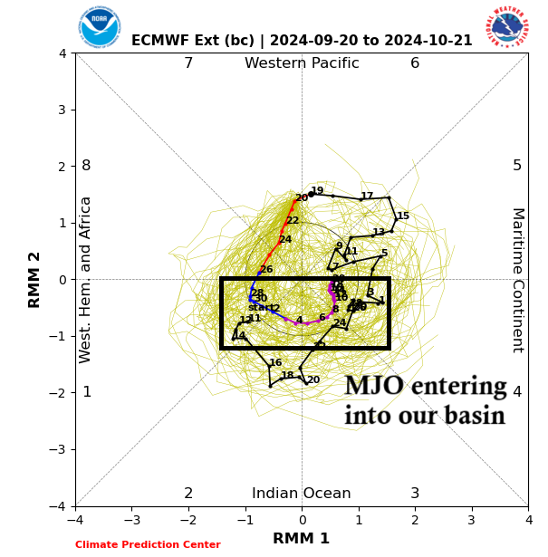
Enduku antha deficit rainfall, emi papam chesindi maa Rayalaseema ?. The rains have been focusing more along North Andhra and Central AP Belts, even Telangana as the Low Pressures, Depressions moved close to them but there was very less time for a proper break that could have triggered much needed rains along Rayalaseema region. As per climatology, September last 2 weeks and even October first two weeks, is highly favourable for Rayalaseema region to see an exceptional rainfall. There will be rains in upcoming days, as how I say in this post.
Rains ahead during 23rd – 24th September in Rayalaseema
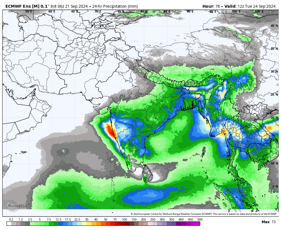
These rains will be due to a low Pressure area moving along Telangana and due to weak winds, Thunderstorms might get triggered along Rayalaseema districts. Even Coastal AP and also Telangana states will see good rains during this period.
29th September to 1st October spell of rains
The ongoing pattern of MJO will push more energy into our region and this will enhance Thunderstorm chances along Rayalaseema as a Wind Confluence zone is being predicted by Models. Wind Confluence zone will cause Thunderstorms to erupt during Night / Mid-Night period causing rapid spread of rains. Lets see how this pans out.